SLAM scanner
Handheld SLAM scanning technology for rapid high-accuracy scanning.
- Simultaneous Localization and Mapping
- Handheld, rapid capture
- High accuracy
- Ideal for large areas
Scan2BIM in Berlin and Brandenburg. Reliable, flexible and fast from one source.
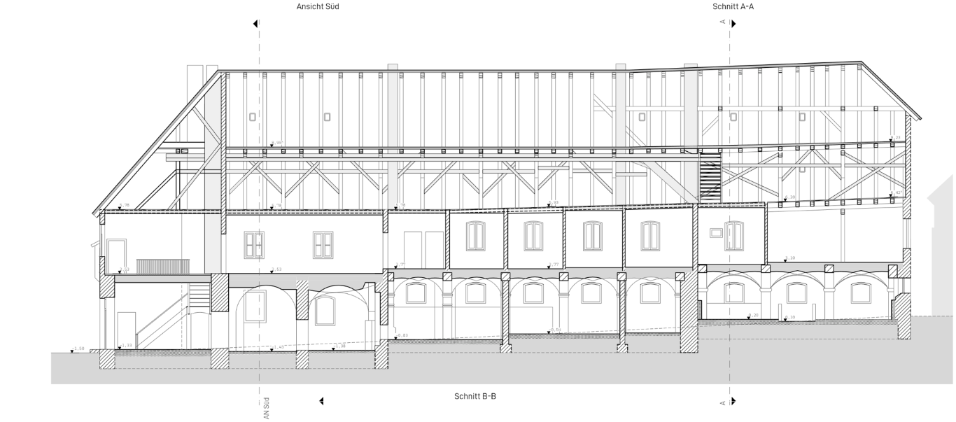
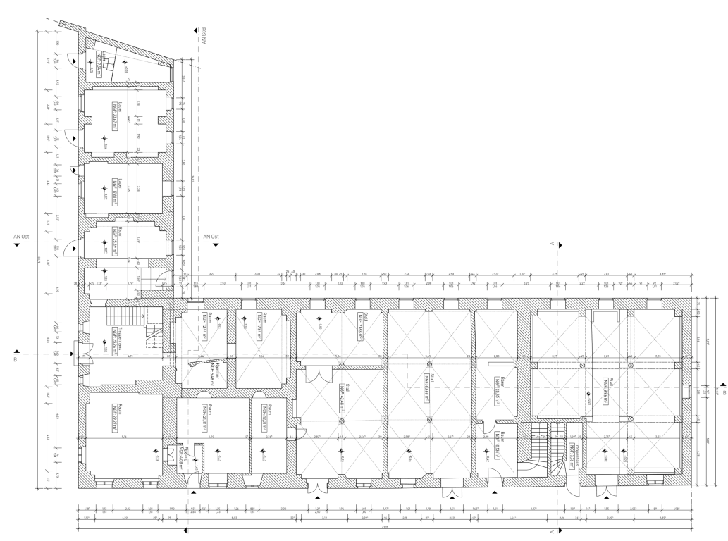
Drawings and 3D models for existing buildings, renovation and new construction.
Terrestrial & mobile. Indoor, outdoor, facade, heritage.
Registered, classified, decimated. Drop-in ready.
Native ArchiCAD as-built models in LOD300.
OpenBIM for BIM in existing buildings. IFC 2x3 / IFC 4 with property sets.
Plans, sections, elevations — optionally in your title block.
German condominium application — Berlin & Brandenburg.
Photorealistic 3D scenes of your building. Walkable view in the browser.
Selected projects and results.
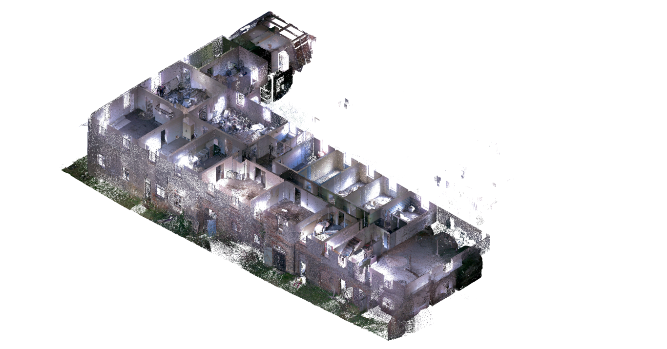
3D point cloud, isometric view with interior cutaway.
On-site scanning in Berlin and Brandenburg. Digital modelling, country-wide.
Travel beyond on request.
Request + files. Fixed quote in 48 h.
Scheduled by arrangement. On-site laser scan.
LOD300, ArchiCAD/IFC. 10–15 working days.
Encrypted link. 30 days of support.
Team, experience and technology.
Team of architects and BIM managers based in Berlin. Experience in all building scales and project stages.
Specialized in existing buildings.
Modern surveying technology for precise as-built capture.
Handheld SLAM scanning technology for rapid high-accuracy scanning.
For highest accuracy scans on demanding projects.
We are open source enthusiasts and donate 1% of our revenue to projects powering the digitalisation of the AECO sector.
Address, area, plans / photos uploaded — we reply with a binding quote and a slot.
Preparation, resident notice, communication — straight from the browser.
How to prepare your property for the LiDAR scan. Printable, free.
Open checklistResident notice as PDF — generated and printed live in the browser.
Create notice